Why do we live here, and how does that relate to the key fire risks and our perception of those risks?
Those of us who live on rural properties face varying degrees of fire risk. Most of us are aware of the risk in a general sort of way, and many of us take active precautions to reduce the risk to some extent. Few of us, however, think about how the reasons for living where we do and the things we value about our surroundings affect both the degree of fire risk we face and, often, the extent to which we act to mitigate risk.
Continually reviewing the values that lead us to live where we do, and the risks we face (whether from fire, flood, or just failures in our food production activities), is a part of ensuring sustainability and resilience in both our lifestyle / habitation the communities in which we live.
The connection between bushfires and our landscape and community values is highlighted in the latest Fire Note (Life on the Edge – Living with Risk) from the Bushfire CRC (Cooperative Research Centre). This Fire Note summarises some outcomes from the Social construct of fuels in the interface project 1 which was conducted by the Bushfire CRC uner one or their activity themes, Understanding Risk.
Part of the research involved working with property owners to understand what they value in their surroundings, how they perceive their fire risks, and whether these are related. It used the technique of “social-ecological place mapping” to assist landowners to understand what it is that they relate to their landscape
The second part of the research applied a model of factors affecting house losses in NSW bushfires (in much milder weather conditions than those leading to Victoria’s Black Saturday losses) to the 65 properties of the residents who did the place mapping, to calculate a relative estimate of their risk of loss to bushfire.
According to the model, the risk of loss increased: with increasing steepness of slope; where houses were closer together (seven metres apart – but this effect was minimal where houses were further (50 metres) apart (and of course this applies to the buildings on your property too); as the distance to the nearest water body (swimming pools, ponds, dams) increased; and when vegetation cover within the garden (within 20 metres of the house) was high.
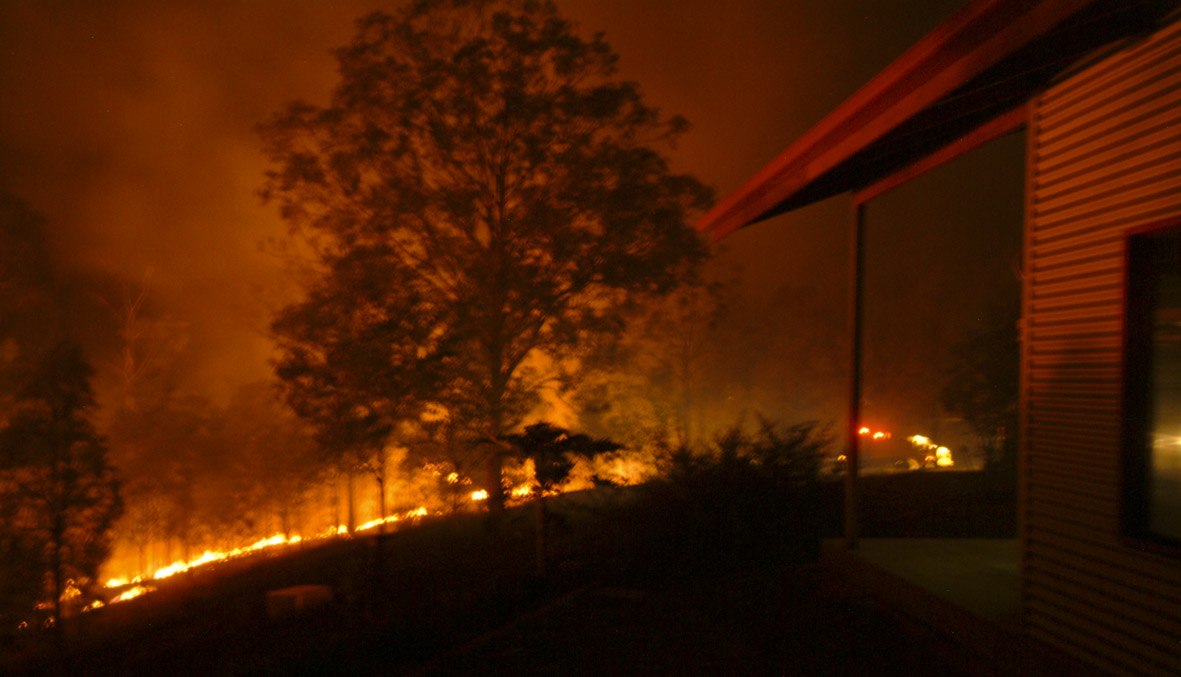
The mean predicted probability of house loss for the 65 houses was 0.43, indicating a substantial potential risk should a fire occur (there was considerable variation among the levels of risk of the various properties). Community and lifestyle values identified by the participants were found to be possible key factors influencing the relative risk of house loss.
There’s a lot more in the report than I can summarise in this short blog post, and I encourage you to read it and the associated reports which are linked here under the heading Key Resources You Should Know About.
This is the 129th Fire Note that the Bushfire CRC has produced. They make informative and compelling reading. They can be downloaded here, from a list of titles with brief summaries of contents.
And on the home front, it’s time to review and update our fire strategies, and to make sure that they are well documented. I’ll do a separate post on our strategies in a few weeks.

Pingback: Tips on bushfire preparedness | Sustainable @ Lockyer Valley